|
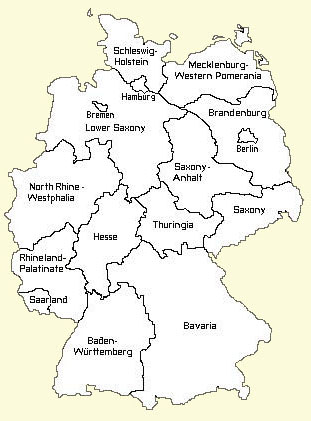
| Map of Modern Germany |
The Zehler homeland is located in the north central region of modern day Saarland, the smallest State in the German Federal Republic. As seen on the adjacent map, Saarland lies on the south-west side of Germany, bordering Luxembourg and France. The Saar area, along with Alsace and Lorraine, has long been contested between France and the German States. Immediately after the French Revolution, the Republican Army took control of these territories west of the Rhine and annexed them to the French Republic. The Saar was controlled by France until the defeat of Napoleon in 1815. Thus, when Peter Zehler was born in 1805, his birth record was written in French and his birth date was recorded using the Calendar of the French Republic.
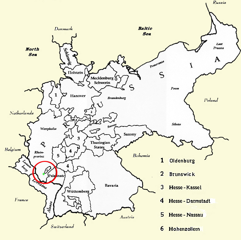 |
| The German States in 1850 |
At the end of the Napoleonic Wars, the Treaty of Vienna ceded much of the Saar district to Prussia, which became part of its Rhine Provence. The map at left shows the German States in1850, which reflects this Treaty. The Saar area is indicated by the red circle. Note the small sliver of land within the circle. This area was granted to the Duchy of Oldenburg and was know and the Principality of Birkenfeld. The villages where the Zehler family lived are near the south west tip of the Principality and are marked with a green asterisk.
Below is an enlarged map of the area where the ancestors of Peter Zehler and Anna Maria Klasen lived. Today it is located in the north central region of the German State of Saarland. The heavy green line on the upper left of the map is the border of the neighboring State of Rhineland-Palatinate and the heavy black lint is where the border of the Principality of Birkenfeld was in 1850.
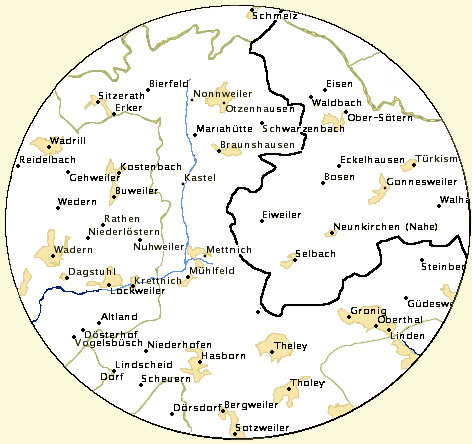
The earliest members of the Zehler family lived in Lockweiler. However, most of Peter's ancestors lived in the village of Mettnich. It was only after his marriage that Peter settled in the tiny hamlet of Nuhweiler.